Takahē and Lake Orbell, Fiordland National Park

Lake Orbell in the Murchison Mountains has long been a restricted area. It is the home of the Takahē Recovery Program. Run by New Zealand’s Dept. of Conservation.

Sure I have a personal interest in all things New Zealand native birds! But the re-discovery of takahē by Dr G. Orbell in 1948 has a link to my childhood. He must have retired to Oamaru from Invercargill in the 1950’s as he used to live next door to my grandparents.

As a little kid I remember him waving to me from a high up window, in his two story house in Reed Street. He always seemed a friendly sort. And by then was definitely famous. So I knew about the takahē from an early age.

Photo courtesy of a DOC interpretation board Te Anau

The Murchison Mountains is a restricted area in the Fiordland National Park. To get a permit would be difficult, as a member of the public.

I’d known this for years, but of course forbidden fruit always leaves room for hankering. It can manifest a sense of mystery. Then one day I discovered DOC in Te Anau run the occasional day trip.

And this is my story of such a day:

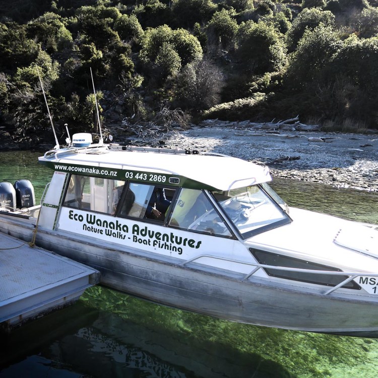
My son on the right, and an old and dear friend on the left get ready to embark on a Real Journeys boat.

The destination across Lake Te Anau takes about 30 mins. to reach. There is a wharf there used for the popular Glow Worm Caves trip.

The trip across reminded us of Dusky, Preservation and Doubtful Sounds to the west across the mountains.

After disembarking we are very soon on our way into some surprisingly rugged country. But the route is quite moderate, as far as such lines go in Fiordland.

The rock on the left is limestone. And as we’re traveling upward parallel to a creek called Tunnel Creek I realised it feeds into the glow worm cave system now below us.

Speleologists can get permission annually to explore 6 + km of caves.

There is predator trap at the bottom of the photo. To the left of the marker.

Taking a breather. The route is relentless. After about two and half hours we branched left off a broad ridge and down a steep descent to said creek.

Red beech is a predominant tree here abouts. And I saw a weka and a tom tit. Occasionally we heard bell birds and south island robins.

After the frustration of not getting a view, suddenly we knew we were close to the real sub alpine environment. So time for a very brief nibble and drink. And refill of drink bottles.

Next we were able to cross the stream dry-shod using some awkward, but thankfully short boulder hops. It took about 30 mins. to get to the nearby hut though. A series of frustrating wind-falls had to be overcome.

And suddenly there we were. The Takahē Heritage hut. And Lake Orbell to be seen on peeking around it’s corner, to the left.

A close up of Lake Orbell. With favoured takahē style habitat to the right.
Looking back at the historic hut
We did not see a takahē though. This was no surprise to me – 16,000 hectares of often boggy and difficult ground would take an age to search. However it’s pretty easy to get up close and personal with them at the Orokonui Eco Sanctuary near Dunedin.

All too soon though – we had to depart to catch the boat back at 5 pm. However not before a welcome brew at the hut.

We had a bonus on the descent.

An older kea followed us down almost all the way. Occasionally on the ground, And when flying – his shadow was constantly zooming over us. Sometimes he’d land on the most wobbly tree branch available, and gyrate about. Perhaps showing off!

This is not the kea though. We had no time to develop a relationship for a modelling session. But this bird is of a similar age.

We made it – bang on 5 pm. To my relief, as I was the slowest.

Looking up Lake Te Anau from the wharf.

For more back ground on the Takahē Recovery Program >>

And on Dr Orbell’s story >>

Unless otherwise above all photos by myself, Donald, or my son Red.

Many thanks for Te Anau Dept. of Conservation and Real Journeys for making this trip possible.

Wilderness verses Access, as it relates to Fiordland, and New Zealand’s largest landslide

At the end of March I headed off with a close photography friend to explore a small area of eastern Fiordland in the Lake Monowai and Green Lake areas.

En-route we met Fiordland artist Wayne Edgerton of Tuatapere, and enjoyed a hour or two with him discussing “light” and art from the perspective of painting and photography…
Artist Wayne Edgerton


Artist Wayne Edgerton


To get into the hills we utilised a road constructed in the 1960s to service two double circuit 220 kV power transmission lines designed to carry power from a Lake Manapouri based hydroelectric power generation scheme being constructed at the same time to supply power to an aluminium smelter being constructed at Tiwai Point near Bluff/Invercargill.

The facility is the largest electricity consumer in New Zealand, and uses approximately one third of the total electricity consumed in the South Island and 13% of the total electricity nationwide, equivalent to about 680,000 households apparently.

Construction of the power station and the road/pylon line attracted controversy for its environmental effects, and over 264,000 New Zealanders signing the Save Manapouri Petition when it was revealed the lake would be raised [and it never was thankfully].

In more recent times I know that many people have pondered that maybe NZ would have been better served to use this energy to build a stronger economy.  This line of thinking has probably not been helped by successive governments, keeping the pricing and deals secret.

Borland Road Power PylonsBorland Power Pylons


Dawn in Fiordland…
Dawn in Fiordland


Dawn and power pylons Fiordland National Park…Dawn and power pylons Fiordland National Park


Fiordland robin…
Fiordland robin


Grebe Valley, Fiordland…
Grebe Valley, Fiordland


To the left of this photo, looking towards Lake Monowai, is the toe of New Zealand’s [and maybe the world’s] largest landslide…
Grebe Valley, Fiordland

It is the largest documented terrestrial landslide in NZ, happening about 12,000–13,000 years ago. The slide is thought to have occurred when glaciers propping up the mountainside melted. With its support gone, a 9-kilometre section of the mountain collapsed into the valley floor 700 – 800 metres below.


This friendly 2 year old kea spent nearly an hour with me – great company…
Kea, Fiordland


Silver Beech forest edge revealed when trees were felled that might compromise the power lines
Silver Beech forest edge, Fiordland


Using an off shoot of the road to gain a good viewpoint…Borland power pylon


As night rolled in with mist on Mt Burns I got my favourite photo for the trip of a small lake above the Grebe Valley, taken from the point where the above mentioned landslide released…
Lake above Grebe Valley, Fiordland


For the whole 3 day trip I kept reflecting how we’d not be able to see and experience this taste of wilderness if it were not for the road, but on balance I think I’d rather know that there is more wilderness going forward, rather than less, as it’s too easily eroded away in the name of business/money.

The sun shines not on us but in us. The rivers flow not past, but through us. Thrilling, tingling, vibrating every fiber and cell of the substance of our bodies, making them glide and sing.

The trees wave and the flowers bloom in our bodies as well as our souls, and every bird song, wind song, and tremendous storm song of the rocks in the heart of the mountains is our song, our very own, and sings our love.

John Muir

How best to look after our precious New Zealand waterways – a personal view by Laurel Teirney of Wanaka

A personal view by by Laurel Teirney, a former manager at Ministry of Fisheries

The success of the community based/scientist/agency approach we adopted for looking after the whole of the Fiordland, and then the Kaikoura Marine Areas makes me feel we’ve struck on a “magic” formula that just might apply to our lakes and rivers as well.

My passion, at the moment, is finding out if such an approach might work for lovely Lake Wanaka – because I have watched in dismay as numerous lakes and rivers have deteriorated in front of my eyes. So something about our current approach isn’t working for our waterways.

Lake wanaka by laurel teirney
Lake Wanaka photo Laurel Teirney


There are those who say a combined community/scientist/agency approach will not work for this lake catchment – but why not give it a go? After all, what have we got to lose? And surely our lake deserves every effort to keep it in the low nutrient, high water quality category into the future for all our sakes!

buff weka
Buff weka family feeding in Lake Wanaka shallows in 2008. This species which had become extinct were once common on the eastern South Island. They were reintroduced from the Chatham Islands onto Lake Wanaka’s Stevenson Island and nurtured in an aviary before releases on Te Pekekara and Waikatipu islands and to Mou Waho Island in Lake Wanaka, where they currently enjoy surprising picnicking visitors.

Obviously a healthy lake is paramount not only for the well-being of these very special birds, but other species as well, notably ourselves!

To me the fundamental principles of the approach to managing the Fiordland Marine Area are likely to be the same for lakes – indeed for any type of waterbody.

1] First, the approach is all inclusive – that is, tangata whenua and every “interest” is represented and everyone selects their own representatives.

Cray fishing boat in Preservation Inlet NZ
Fishing boat in Preservation Inlet, Fiordland, with a cargo of cray “pots” [actually cages – lowered near rocks and pulled up again after a few days]. This is financially a high stress job, and dangerous. Also it’s a very different use of the environment compared to recreational fishing, and tourism

2] Then, when the representatives are around the table the first task is to agree on a shared vision. At our first Fiordland meeting in December 1995 there was a palpable sense of unease around the table. But when we went around the table and each person said how they wanted to see the Fiordland Marine Area in 20 years’ time, the unease was replaced by outright surprise – because everyone wanted the same thing!

Diving in Preservation Inlet, Fiordland NZ
A recreational diver in Preservation Inlet, Fiordland NZ. 2015. Diving for photos only due to it being a Marine Reserve, and as mentioned below not much is known about this area e.g. the fresh water layer here, on top of the salt water was approx. 5 meters, and nobody seemed to be aware of this – elsewhere it’s typically 1-2 meters

3] From then on, the primary focus stayed with the Fiordland Marine Area, not the desires of any participating group.

Marine reserves 3
Dusky Sound, Fiordland

4] Given the isolation of Fiordland little had been documented about the marine area – so the priority was to gather together what was known. Following the shared vision at the first meeting a large map of Fiordland was laid on the floor. Each group was given different coloured dots and asked to place them on the map according to the locations they valued. Red rock lobster and purple paua dots appeared rapidly all along the coastline. But the blue recreational dots were slower in coming – as we all know rec fishers are a bit reluctant to share info about where they fish…..but when they considered what might happen if they didn’t show their dots they too were around the map and the shared observations and experiences filled the room. Only then did Stewart Bull of the Oraka/Aparima runanga, calmly walk up to the map and place a single yellow Ngai Tahu dot way out in the ocean. Silence fell and then some-one asked “Hey Stu what were you doing way out there?” And he calmly replied, “Oh just looking around”. And that set the tone for the rest of the process – lots of good humour and camaraderie.

Dusky Sound, Fiordland National Park, New Zealand
Good humour is often evident in Fiordland, especially on the rare sunny day! A pessimist in Dusky Sound, Fiordland does therefore standout – near where Capt. Cook anchored up in Pickersgill Harbour for a month, after a circumnavigation up to three quarters of Antarctica.

One other experience of community knowledge that has stayed with me was the identification of the lines defining the inner fiords from the outer coast. I’ll never forget Pete Young, a blue cod and rock lobster fisher, standing at the maps marking exactly where those lines should be with input and encouragement from the rest of us. It wasn’t until several years later that Steve Wing, our marine scientist, produced data that simply reinforced the lines Pete had drawn.

Long Sound, Fiordland
No place to be in a 4 meter alloy tender with serious white water wanting to drive the bow under, and we’re upstream of a large rock, with all but 5 mm of it submerged – the head of Long Sound in Preservation Inlet, Fiordland

5] And so to the roles of the community and agencies involved. These were complementary right from the start and best described by an “egg analogy”. The yolk represents the community – all passion, commitment and knowledge about their place. The white represents the agencies – all support, advice and management tools for putting the management decisions in place. And there has been an additional benefit as the agencies now work in teams for every issue they deal with.

To me, this approach harnesses all the knowledge, all the passion and all the energy that leads to innovative solutions for even the most difficult issues.
And ongoing motivation is assured by the delight and reward of being involved in looking after one’s own place.

So my “dream” is to see many more of our waterways, be they lakes, rivers or marine areas looked after in such a way. Top of FormAnd logically, extending this from the mountains to the sea (ki uta ki tai), whole catchments could be managed in such a way – though the logistics are rather mind blowing I have to admit!

In the meantime though, I’m just going to continue advocating for a Lake Wanaka Community Management Plan.

Wanaka water purity
The depth of water under the boat at Mou Waho Island on Lake Wanaka is deep enough to engender a sense of vertigo, it’s so clear. So “clear” that maybe we take it for granted!

Sunset - Dusky Sound, Fiordland
Sunset – Dusky Sound, Fiordland, New Zealand

Unless stated otherwise all photo credits are Southern Light

Takahe – back from the brink | Our Changing World | Radio New Zealand

A few days ago I came across a FaceBook post by Radio NZ about the growing numbers of takahē [one of NZ’s rare flightless birds threatened by extinction] and was so intrigued by it I’ve gathered together some information, and included a link to their article below.

Takahē were rediscovered above the bush line amongst the snow tussock and sub alpine plants of Fiordland’s Muchison Mountains in 1948 by Dr. Orbell , who as it turned out was a neighbour of my grandparents.

Fiordland, Muchison mountains from Lake Te Anau. Photo by Southern Light
Looking southwards to the Muchison Mountains from Lake Te Anau. Photo by Southern Light. Takahē live above the bushline among snow tussock and sub alpine plants/scrubs

And so from a very early age some years after his significant achievement I was aware of his fame, but too young to recall meeting him apart from some hazy memories of him waving from a top-floor window.

Fiordland
Days like this are all the more magical in Fiordland because the norm is rain~ this photo by Southern Light is of a small lake to the north of the Muchison mountains

Once thought to be extinct their re-discovery was followed by decades of conservation effort, yet even today they remain on the ever growing “critically endangered” list. Amazingly they have clung to existence despite the pressures from hunting, habitat destruction and introduced predators.

The phrase “clinging to existence” belies an enormous amount of patient work over six decades on the bird’s behalf and also their habitat.

Why so long, you may ask? Well, the situation in this country where so many bird species evolved in an environment devoid of mammals [excepting bats] meant there were no defences when predators arrived.

We have had to implement the defences, and no one in the world has ever dealt with this scenario so unique. Which really means there has been a lot of experimentation underscored by the odd mistake. Fortunately we’ve been able to react lightly and move on to reach this amazing goal of 300 birds up from several!

Rain in Fiordland
This is more the norm in Fiordland. Photo by Southern Light

Takahē come from times when many large flightless birds were spread throughout the country. They do have wings, but are flightless and only occasionally use them for display during courtship, or as a show of aggression.

Photo from RadioNZ’s article

Takahe numbers have reached 300, for the first time in more than 50 years. It’s a milestone for the endangered bird, which has been the subject of a marathon conservation effort following its dramatic rediscovery in 1948.

Read more at the source: Takahe – back from the brink | Our Changing World | Radio New Zealand