Hello, here is a time lapse taken of the amazing austral auroral display on 27-28 February 2023. As seen from The Snow Farm, Cardrona Valley, New Zealand
Made out of about 180 images taken automatically over approx. 4 hour period. And for this lot I was asleep tucked up in my 4wd camper truck. I’d tied the camera tripod down and it’s weather proof up to a point. And it kept doing a 15sec exposure every 50 secs until the battery went flat.
The Importance of Protecting a Historic and Heritage Landscape in Central Otago, New Zealand
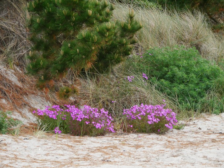
Buster Diggings is a historic gold mining site located near Naseby in Central Otago, New Zealand. The site was active from 1863 to the early 1900s and reached a population of over 700 people at its peak. The Department of Conservation (DOC) now manages the site as an Actively Conserved Historic Place and it is listed several times in the Conservation Management Strategy (CMS), a statutory legal document. Prescriptive in nature. The site is considered to be remarkably intact and of national significance, particularly for its rarity as a high-altitude, alluvial mining landscape. It is comprised of fine cream coloured auriferous-quartz gravels.
Unfortunately, the site is suffering from human impact, primarily from 4wd vehicles and motorbikes, which are driving up the sluice faces for no other reason other than pushing a vehicle to it’s limits. Thus leaving long-term wheel marks or scarring on the surface of the deposits, causing erosion.
Evidence of high risk driving and riding
Using momentum in a four wheel drive to get up a steep slope can be hazardous due to several reasons. One of the biggest hazards is the loss of control if the vehicle fails to make it to the top. In such a scenario, the momentum of the vehicle puts it in a precarious position that makes it difficult or even impossible to control the descent backwards. This can lead to serious accidents, such as a rollover, especially if the slope is steep and the surface is loose or slippery.
Additionally, over-reliance on momentum can put excessive strain on the vehicle’s drivetrain and suspension, potentially leading to mechanical failures. It’s always important to carefully assess the terrain and plan a safe and controlled ascent (or possible descent when traction becomes compromised).
Acknowledgement of the problem
DOC acknowledged this impact many years ago and erected a fence around the main sluice faces at the head of Clarks Gully in 2009. However, stronger protection measures, such as a stronger fence or the use of cameras to identify vehicle users rego (and forward to the Police), could be considered.
More than once the lock on this gate, will I daresay, have succumbed to a bullet many times.
However…
Education plays a crucial role in the success of any management program.
By educating the public, individuals are empowered to make informed decisions and take ownership of their role in achieving the desired outcome.
This approach is more effective in the long term as it creates a sense of shared responsibility and fosters a culture of sustainability.
Furthermore, educating the public also helps to build trust in the management program and its goals, as individuals are better equipped to understand the reasoning behind specific policies and actions.
Ultimately, an educational approach leads to a more engaged and invested community, resulting in greater buy-in and higher rates of success for the management program.
DOC (Department of Conservation) Interpretation Boards are an effective tool for public education as they provide information and context to the public about the local environment, conservation efforts, and the cultural and historical significance of an area. The boards can also help foster appreciation and respect for the environment, which can lead to greater support for conservation efforts.
In Conclusion
Buster Diggings is a historically significant and rare site in Central Otago, New Zealand, that is currently suffering from human impact. DOC has a responsibility to protect the site and mitigate the risks posed by 4wd vehicles and motorbikes. Stronger protection measures should be considered to preserve the site for future generations to enjoy and appreciate.
CONSERVATION MANAGEMENT STRATEGY Otago 2016
Page 51-57 on pdf: The history of the Place is protected and brought to life at the Ngāi Tahu site of Manuhaea Conservation Area at The Neck and at the Buster Diggings actively conserved historic site.
The historic Buster Diggings has to be a protected and actively managed accessible visitor site.
Braided rivers are a common in Alaska, Canada, New Zealand’s South Island, and the Himalayas, which all contain young, rapidly eroding mountains. They are a unique environment inhabited by equally unique birds.
They simply cannot contain a river in a straight line. In floods especially they carry sediment, and in places where the flow slows down this settles on the bottom, thus raising it. And the water flows off to the side of least resistance. This will happen constantly during floods.
The technique for gathering bird numbers on these sort of rivers is quite simple: a team of four people spread out, in radio contact with each other, walk downstream counting every bird they see in front of them. On the ground or airborne.
And at that point the simplicity vanishes! Very finely tuned river crossing skills are needed, as well as “an eye” for the line that will give the best results. Plus physical stamina.
The tools of the trade are: a radio each, walking pole to aid crossings, binoculars, sun-cream, sun hat, good boots and gaiters [to stop gravels getting in the socks], GPS each, and a pen/paper/clipboard. Plus lunch, warm clothing, a camera etc. Warm dry socks also help at the end of the day.
A view upstream of the Hunter River that feeds Lake Hawea in Otago, New ZealandPreparation. In this case to get into the very remote Hunter Valley. In the Wanaka area two other rivers, the Matukituki and Makarora are also done, and they don’t require a helicopter drop in. There is 25 years now of history – each river being monitored every third year.
The three year cycle is sometimes hard to maintain. The work has to be done in the spring when the birds are breeding, and this is when there is a high frequency of floods, with high levels due to snow melt.After a short but steep climb in the helicopter from Makarora town-ship, on popping over the ridge the large and rugged Mckerrow Range come into full panoramic view [actually named after a close friend’s grandfather who did lots of surveying and exploring. Dropping the over-night gear off by a hut, before flying further up the valley to begin the survey.On the left [note the silt in the grass!] where we only go to avoid a complex river crossing; and where we do – the gravel on the right.One species of many that we’re looking for. The nationally vulnerable banded dotterel / tūturiwhatu, is the most common small plover of New Zealand seashores, estuaries and riverbeds.
This one is feigning a broken wing to lead the surveyor/photographer away from a nest.
After breeding, they either remain at the nesting area or move relatively short distances to nearby estuaries.Typical nesting surface, and one of the team striding it out. Being very careful to not stand on eggs!On the wing. A black fronted tern. Not in the Hunter though, but the Tasman River near Mt Cook. The blue colouring of the very cold water is caused by rock ground up by glaciers.
There are about six species that are primarily dependent on the braided river habitat: wrybill, banded dotterel, south island pied oyster-catcher, black-fronted tern, black-billed gull, black stilt) as well as the caspian tern and the pied stilt. The villain of the piece though is the black-back gull, as they predate on the eggs of the others.
Teaming up – linking arms for mutual support. Lots of concentration is required so it’s harder to observe what maybe in the air ahead. However the most experienced person leading the crossing, which is nearly done, has in this instance time to look. River crossing is best done by not looking down, which upsets balance, and with great care – there is no Plan B if people get swept away.When not to cross at all – just too big and not braided into smaller channels.The job is going well!What we don’t want to see, but if we do, weeds are recorded as Way Points on a GPS, so that DOC staff can return later to deal to them. The most often encountered on the above mentioned rivers is this area, is often broom.
We don’t encounter many lupins in the above mentioned rivers. This photo is in the nearby Ahuriri. Lupins, which the birds don’t like, offer cover to predators. Foolishly seeds were spread many decades ago by well meaning people wanting to add some colour to the grey landscape. And the seeds can remain for years until uncovered by a flood as they’re coated with a protective oil.A sad aspect of some surveys is that we know that after a bank-to-bank spring flood hundreds of these young birds are washed away. These are a few surviving gulls after such an event in the Matukituki a few years back.Knock off time – a classic old-time hut.Every hut has oneEvening and time for sleep. Tomorrow morning the survey will resume tidying up the riverbed to the right.Job over and pickupThe long and sometimes bumpy drive home beside Lake Hawea
Obviously the results of such monitoring give a good guide as to the health of the environments concerned.
However the data as regards where breeding colonies are located, can be used for the most efficient locations for a new trapping lines. There is an attrition of traps though – during floods despite them being anchored by a chain to a long steel stake hammered in, they get washed away. Often the best compromise often considered, is for them to be near a bank that exhibits a history of stability, and place them with a shorter distance apart than the 200 mt standard in the bush, so as to create a fence of sorts.
A few months ago I was privileged to be appointed to the Otago Conservation Board. Such appointments are made by the Minister of Conservation. The first duty of a member is to work to achieve the statutory interests of the board.
Members are not representatives for any cause or organisation. Board meetings are public, and organisations can ask to be heard at them.
There are 15 Boards in NZ and each one is independent of any other body, and have a statutory obligation to represent the public interest in DOC’s work, and conservation in general within their region by advising DOC and the New Zealand Conservation Authority on planning and strategic direction.
A board can be requested by DOC to advise on issues like biodiversity, the use of public land, and concessions (a business may apply to use such land for their operations).
One of the first ones I became involved with was commenting on some old historic dwelling in the Aramoana Spit near Dunedin. In this case the owners of the houses have applied for a concession for them to stay on Conservation Land. They were built maybe 80 years ago, predating not only DOC, but goodness what other land designation.
Some field trip notes and images
The view along the spit – north is to the left. The 4 dwellings are at the far end, 3 of under the large trees. Note that 40 years ago the dunes were further to the left – right up to the tide line in fact. This is also the most popular beach for locals swimming.On the other side of the dunes, to the south towards Dunedin, there are very extensive salt mudflats. The locked access road to the dwellings sidles along the south side of the dunes, with the very extensive salt mud flats on the right. It seems perfectly placed to not interfere with the local wildlife, which at the moment consists of sea lions in the dunes near the houses, and not penguins. Perhaps they’re not compatible?There are a few gullies through the dunes that lead to the beach from the access road. Yes, those are dog prints.Great views of Tairoa Heads. The first dwelling on the extreme right – the 3 far more substantial houses are under the trees…I loved the kiwiana style, and btw this is not one of the pilot’s houses. At this point there is an imaginary line between dunes and sea lion habitat to the photographers right, while at the left starts a different vegetation zone comprised of seemingly of a bit less sand.The second pilot’s house really close by, with path to the beach…More kiwanaAt this point the environment to the south, towards Dunedin is no longer salt marshThis roof faces the sunny north!Out on the spit, as opposed to the dunes, we have a few invasive speciesOne way to enjoy the view northSea lion pup asleep in the dunes
At the time of publishing here a submission has been sent to DOC of the Board’s recommendations, but at this point I don’t know what the outcome will be.
This is the last of three series of a roadie trip down what is known as the Catlins, in Coastal Otago
Part of large gathering of oyster catchers at PapatowaiClassic kiwana at the car park to Jacks Blow holeSea lions enjoying the sunKererūSea lion feeding at WaipapaThe black oystercatcher is quite conspicuousWaipapa point and lighthouseSo typical of the wildness of coastal SouthlandView from FortroseThe awesome Waituna lagoon – one the largest in New Zealand, and refuge to countless biodiversity Flax flowers at WaitunaMore kiwana at Waituna lagoon